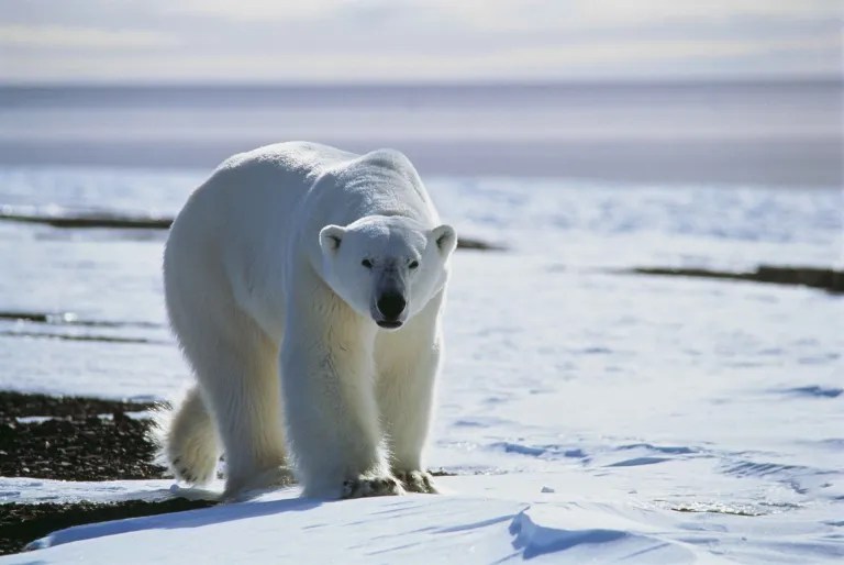
Two dead in fatal polar bear attack in Alaskan village of Wales on the Bering Strait
Polar Bear Science | January 18, 2023
Two people tragically died yesterday afternoon after an attack by a polar bear in the village of Wales on the Bering Strait. Few details are available and bad weather apparently hampered officials getting to the village immediately.
As expected, virtually all news reports are implying that a generic ‘lack of sea ice’ can be blamed for the incident. As usual, the specifics of this case show this claim is not only nonsense, but dangerous.
With the loss of sea ice and the ocean staying open later in the year, polar bears have been spending more time on land, which increases the chance of human encounters, said Joseph Jessup McDermott.
Polar bear attacks in winter are almost always associated with a bear that has not been able to resume feeding in the fall. More bears and restricted hunting means more young bears (as well as old bears or sick ones) become food stressed because they can’t compete with big mature males for food. Mature bears often steal any seals that young bears are able to kill, making the youngsters desperate for food.
The Chukchi Sea polar bears are currently thriving and numbers may still be increasing (AC SWG 2018; Conn et al. 2021; Regehr et al. 2018; Rode et al. 2014, 2015, 2018).
More details to follow on this horrific incident as they become available.
UPDATE 18 January 2023, 5:30PM PT: According to an Associated Press account, the victims were a 24 year old woman and her one-year old son: “Summer Myomick of Saint Michael and her son, Clyde Ongtowasruk, were killed in the attack, Alaska State Troopers said in a statement.”
No more details were provided on the state of the bear involved (sex, age, body condition). Regarding the blame-game, even though recent studies have shown that ringed and bearded seals in the Chukchi Sea are doing very well (Adam et al. 2019; Crawford and Quakenbush 2013; Crawford et al. 2015), Geoff York from Polar Bears International suggests there may not be enough seals for polar bears or the something may be wrong with the sea ice:
In this case, even though there is ice in the Chukchi and northern Bering seas, the quality of that ice is not known that well. More importantly, York said they don’t know what’s going on under the ice — or what the availability of seals and other prey is for polar bears.
The changes are also happening in winter, when people assume they are safe from polar bears being on shore.
“Communities may no longer be,” York said.
From the Alaska Daily News report (17 January 2023):
A polar bear killed a woman and boy Tuesday afternoon in the Northwest Alaska community of Wales, according to Alaska State Troopers. Troopers received a report of a polar bear attack around 2:30 p.m., troopers said in an online report.
According to initial accounts, a polar bear came to the village and chased several residents, troopers said.
The bear killed a woman and a boy, troopers said. Another Wales resident shot and killed the bear “as it attacked the pair,” troopers said.
The two people who were killed in the mauling weren’t identified in the report, and troopers said officials are working to notify their next of kin.
Austin McDaniel, a spokesman for the Alaska Department of Public Safety, said troopers are coordinating with the Alaska Department of Fish and Game as they try to send personnel to Wales as soon as the weather allows.
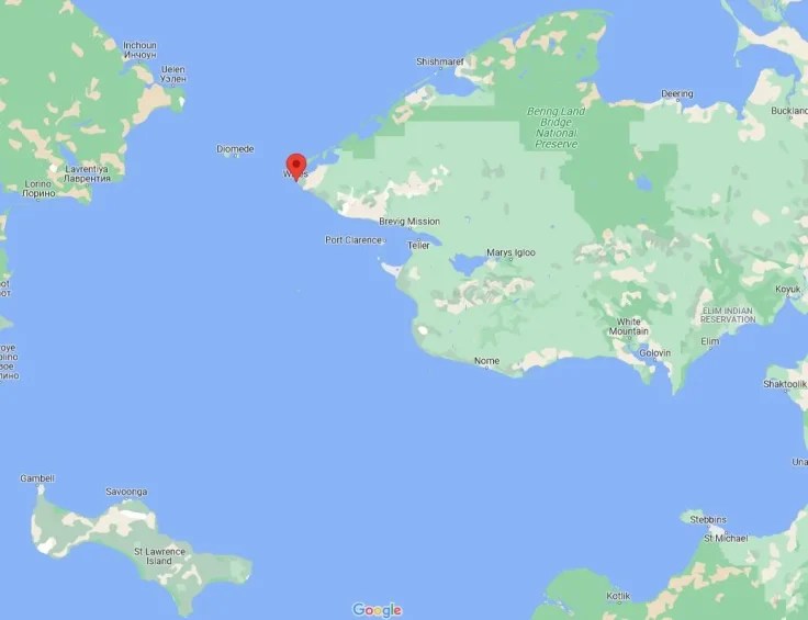
Wales — a predominantly Inupiaq village of fewer than 150 people — is located on the far western edge of the Seward Peninsula bordering the Bering Strait, just over 100 miles northwest of Nome.
… Some communities in Alaska — for example, several on the North Slope — have had polar bear patrols to keep residents safe. That’s not currently the case in Wales.
“Wales does not currently have an active Polar Bear Patrol Program due to lack of government funding, unlike the North Slope,” McDermott said, “but this is something that ANCC has sought to pursue with other (nongovernmental organizations).”
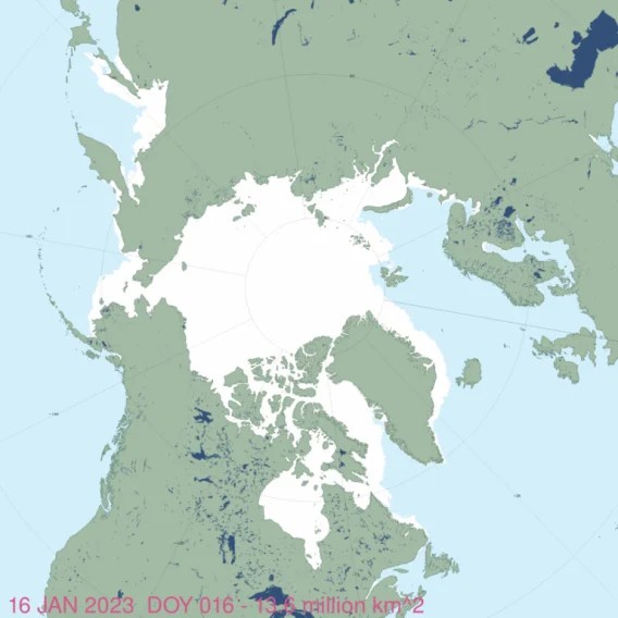
There is ample sea ice in the region at the moment:
References
AC SWG 2018. Chukchi-Alaska polar bear population demographic parameter estimation. Eric Regehr, Scientific Working Group (SWG. Report of the Proceedings of the 10th meeting of the Russian-American Commission on Polar Bears, 27-28 July 2018), pg. 5. Published 30 July 2018. US Fish and Wildlife Service. https://www.fws.gov/alaska/fisheries/mmm/polarbear/bilateral.htm pdf here.
Adam, R., Bryan, A., Quakenbush, L., Crawford, J., and Biderman, L.2019. Bearded seal productivity in Alaska using harvest-based monitoring, 1975-2016. Poster presentation, Alaska Marine Science Symposium, 28 January-1 February.
Abstract: Declines in arctic sea ice extent, thickness, and duration are projected to negatively impact bearded seals (Erignathus barbatus) by reducing their time to rest, pup, nurse, and molt on sea ice. Existing population estimates for bearded seals in Alaska cannot be used to detect trends; however, the Alaska Department of Fish and Game works with Alaska Native hunters to collect data from the subsistence harvest that are used to determine several population health indices, such as: pregnancy rate, age of maturity, and the proportion of pups in the sampled harvest. These indices were previously used to determine if declines in sea ice have affected bearded seals between 1975–1984 and 2003–2014.
During these time periods pregnancy rates varied minimally (92–99%); however, the average age of maturity decreased from 4.2 years in 1975–1984 to 2.9 years in 2003–2014. Additionally, pups were harvested in lower proportions during 1975–1984 than during 2003–2014 (26% and 48%, respectively), indicating that pups are still being produced, weaned, and are surviving to be harvested. Through 2014, we have not detected the decreases in population indices that have been predicted to occur with climate change. However, due to continued declines in sea ice, further monitoring is important; therefore, here we update our 1975–2014 results to include samples from 2015 and 2016.
Cameron, M. F., Bengtson, J. L., Boveng, J. K., Jansen, J. K., Kelly, B. P., Dahle, S. P., Logerwell, E. A., Overland, J. E., Sabine, C. L., Waring, G. T. and Wilder, J. M. 2010. Status review of the bearded (Erignatha barbatus). NOAA Technical Memorandum NMFS-AFSC-211.
www.afsc.noaa.gov/Publications/AFSC-TM/NOAA-TM-AFSC-211.pdf
Conn, P.B., Chernook, V.I., Moreland, E.E., Trukhanova, I.S., Regehr, E.V., Vasiliev, A.N., Wilson, R.R., Belikov, S.E. and Boveng, P.L. 2021. Aerial survey estimates of polar bears and their tracks in the Chukchi Sea. PLoS ONE 16(5): e0251130. https://doi.org/10.1371/journal.pone.0251130 OPEN ACCESS video: https://doi.org/10.1371/journal.pone.0251130.s003
Crawford, J.A., Quakenbush, L.T. and Citta, J.J. 2015. A comparison of ringed and bearded seal diet, condition and productivity between historical (1975–1984) and recent (2003–2012) periods in the Alaskan Bering and Chukchi seas. Progress in Oceanography 136:133-150.
Regehr, E.V., Hostetter, N.J., Wilson, R.R., Rode, K.D., St. Martin, M., Converse, S.J. 2018. Integrated population modeling provides the first empirical estimates of vital rates and abundance for polar bears in the Chukchi Sea. Scientific Reports 8 (1) DOI: 10.1038/s41598-018-34824-7 https://www.nature.com/articles/s41598-018-34824-7
Rode, K.D., Regehr, E.V., Douglas, D., Durner, G., Derocher, A.E., Thiemann, G.W., and Budge, S. 2014. Variation in the response of an Arctic top predator experiencing habitat loss: feeding and reproductive ecology of two polar bear populations. Global Change Biology 20(1):76-88. http://onlinelibrary.wiley.com/doi/10.1111/gcb.12339/abstract
Rode, K. D., R. R. Wilson, D. C. Douglas, V. Muhlenbruch, T.C. Atwood, E. V. Regehr, E.S. Richardson, N.W. Pilfold, A.E. Derocher, G.M Durner, I. Stirling, S.C. Amstrup, M. S. Martin, A.M. Pagano, and K. Simac. 2018. Spring fasting behavior in a marine apex predator provides an index of ecosystem productivity. Global Change Biology http://onlinelibrary.wiley.com/doi/10.1111/gcb.13933/full
Rode, K.D., Wilson, R.R., Regehr, E.V., St. Martin, M., Douglas, D.C. & Olson, J. 2015. Increased land use by Chukchi Sea polar bears in relation to changing sea ice conditions. PLoS One 10 e0142213.
Coronavirus Crackdown Madness at the Alaska State Senate

By Adam Dick | Ron Paul Institute | March 11, 2021
Over the last few weeks, coronavirus crackdown mandates, including mask wearing requirements, have been rolled back in several states. But, in Alaska, the state Senate is proceeding with a looney and pernicious crackdown on one of its own members because she has not fully complied with a list of coronavirus-related rules for the capitol. The rules, including required mask wearing, are supposedly purposed to counter coronavirus.
Andrew Kitchenman reported Wednesday at Alaska Public Media that the state Senate has voted to allow Senate leaders to enforce coronavirus-related rules against Sen. Lora Reinbold. The result is Reinbold, who has chosen neither to wear a mask nor to undergo — and report the results of — mandated repeated coronavirus-related medical testing, being prohibited from entering the capitol other than the Senate gallery from which she will be able to vote while the Senate is in session.
No more in person attendance at committee meetings, including of the Judiciary Committee of which she is chair, for Reinbold. No more joining in the debate on the Senate floor either. Reinbold is even being booted from her office in the capitol, relegated to using office space elsewhere.
Here’s to Reinbold standing up to the bullies. It sounds like that is just what Reinbold intends to do. Kitchenman shares in the article this quote from Reinbold’s Facebook page: “My actions are to protect my constitutional rights, including civil liberties and those who I represent, even under immense pressure and public scrutiny.”
Copyright © 2021 by RonPaul Institute
Lakes For Sale, Partially Thawed, N=20
By Willis Eschenbach | Watts Up With That? | February 5, 2014
Anthony pointed out the selling of over-hyped claims of the “dramatic thinning” of Arctic ice here. The title of the underlying scientific study is much more prosaic, Response of ice cover on shallow lakes of the North Slope of Alaska to contemporary climate conditions (1950–2011): radar remote-sensing and numerical modeling data analysis. (PDF). To their credit, the authors make no such claims of drama in their text, which is generally quite appropriately restrained.
Here is their complete “dramatic” dataset of the lakes around Barrow, Alaska, the northernmost point in the US:
 Figure 1. Percentage of lakes in the low-lying tundra around Barrow, Alaska that are partially thawed in late April, 1992-2011. Photo Source.
It’s an interesting study. They noted that partially thawed lakes look very different on radar than when the same lakes are frozen solid. As a result, they’ve collected solid data that is not affected by urban warming. So … what’s not to like in the study? Let me start with what is to like in the study.
I do like the accuracy of the measurements. It’s an interesting metric, with very objective criteria. I like that they listed the data in their paper, and showed photos for each of the years. I like that they didn’t try to project the results out to 2080.
What I didn’t like is where their study went from there. After collecting all that great data, they immediately sent out for that perennial favorite, a global climate model … not my style at all.
So rather than pointing out that their study is models all the way down, I figured I’d just show the kind of analysis that I would do if I were handed the lake thawing data.
First thing I’d need for the analysis? MORE DATA. Piles and piles of data. So I went out and I dug up two datasets—Barrow temperature, and Barrow snow depths. I started with just the temperature, but it turns out that the correlation between temperature and the lake thawing isn’t all that good. It doesn’t explain much, the best correlation is with temperatures in December, 4 months prior to the thawing, at a correlation of 0.68. However, at least it gives a good idea of what’s been going on, because we have good records clear back to 1920.
 Figure 2. Winter temperatures in Point Barrow (pale blue line) and the 17 year Gaussian average of the data. Photo source http://www.panoramio.com/photo/63484316
I note in passing that Barrow has a well-documented Urban Heat Island that is at its strongest in winter … and despite that, the 1930s and 1940s both had warmer winters than the last decade. I also note in this context of winter-business-as-usual that the study says:
Climate-driven changes have significantly impacted high-latitude environments over recent decades, changes that are predicted to continue or even accelerate in the near future as projected by global climate models …
… but I digress.
So the next obvious suspect for a correlation with the lake thawing is the snow depth. It’s an odd fact of nature that snow is a good insulator. It both slows down heat transfer by insulating the surface, and it keeps the wind from contacting the ice.
So I looked at the average snow depth data (scroll down to “Custom Monthly Listing” in sidebar) … but it’s not all that good at emulating the ice thawing either—in fact it’s worse. With snow depth, the best correlation with average snow depth is only 0.51, again with December coming out on top. So, having investigated single variables to try to emulate the lake thawing, I turned to the combination of snow depth and temperature … not much luck there either. In fact, the only way I could get a good correlation was to use the combination of the Nov-Dec-Jan average temperature, and the December snow depth. This gave me a correlation of 0.81, and a p-value of 0.001 … which turns out to be just barely significant. Here’s the emulation:
 Figure 3. Emulation of Barrow lake thawing. Observations (thick red line) compares well with the emulation (thin green line). Correlation is 0.81, p-value is .0010.
Now … why did I say that a p-value of 0.001 is “barely significant”, when the usual level is a p-value of 0.05? Well … because I looked at so many possibilities before finding what I sought. All up, I looked at maybe 40 possibilities before finding this one. If you want to establish significance at the level of a p-value of 0.05, and you look at 40 datasets before finding it, you need to find something with a p-value less than 1-10(LOG(0.95)/N, where N is the number of datasets you looked at. For N=40, that gives a required p-value of better than 0.0013 … so with a p-value of 0.0010, my emulation just made it under the wire.
Next, I looked at what that same emulation would look like over the whole period 1950-2013 for which we have records, and not just the period 1992-2011 of the study (the “N=20″ of the title). Figure 4 shows that result.
 Figure 4. Exactly as in Figure 3, but covering the entire period of record.
OK … not a lot going on there. Now, those who follow my work know that I’m quite skeptical of this kind of modeling, particularly with such a short record. What I do to test that is first to find a model with an acceptable p-value. Then I take a look at both the emulation shown above, along with the same emulation using just the first half of the data to fit the parameters, and then the same thing using just the second half of the data. Figure 5 shows that result:
 Figure 5. As in Figure 4, but showing the emulation based solely on the first half of the data (light blue), and that based solely on the second half (dark blue)
As emulations go, in my experience that’s not bad. The general shape of the emulation is well maintained, and neither of the two half-data emulations go far off of the rails, as is all too common with this type of analysis.
So that’s how I’d analyze the data, at least to begin with. My conclusions?
Well, my first conclusion has nothing to do with the lakes. It has to do with Figure 2, which shows that there is nothing out of the ordinary happening to Barrow winter temperatures. So whatever you might want to blame the lake thawing on, it’s not the local temperature. It’s hasn’t much changed over almost a century, it just goes up for a while and then down for a while.
The second conclusion is that the changes in the lake thawing dates over the period of study are not “dramatic”. In fact, they are boringly mundane. The only thing “dramatic” is the press release, which is no surprise.
The third conclusion is that I wouldn’t trust my emulation of lake thawing all that far … the problem is that with N=20, we have so little data that any conclusions and any emulations will be fraught with uncertainty. Heck, look at Figure 1 … up until a few years before the end of the data there was not even much trend. It’s just too short to conclude much of anything.
Next, I wouldn’t trust their “CLIMo Lake Ice Model” much further than I’d trust my emulation above. Again, the underlying problem is lack of data … but to that you have to add the unknown performance of the CLIMo model.
Finally, while the authors were restrained in their study, they cut loose in their quotes for the press release, viz:
“We’ve found that the thickness of the ice has decreased tremendously in response to climate warming in the region,” said lead author Cristina Surdu, a PhD student of Professor Claude Duguay in Waterloo’s Department of Geography and Environmental Management. “When we saw the actual numbers we were shocked at how dramatic the change has been. It’s basically more than a foot of ice by the end of winter.”
and
“Prior to starting our analysis, we were expecting to find a decline in ice thickness and grounded ice based on our examination of temperature and precipitation records of the past five decades from the Barrow meteorological station,” said Surdu, “At the end of the analysis, when looking at trend analysis results, we were stunned to observe such a dramatic ice decline during a period of only 20 years.”
I see nothing “stunning” or “dramatic” in their results at all. Overall, it’s quite ho-hum.
My warmest regards to all, it’s bucketing down rain here after a long period of drought, life is good.

War From Above
By Richard Hugus | Aletho News | December 31, 2013
Drone aircraft, which we first heard of as weapons of war used by the United States in foreign lands, are now poised for a full-scale invasion of the skies above the US itself. On December 30, 2013 the US Federal Aviation Administration announced its choices for drone testing in six states around the country — Alaska, Nevada, New York, North Dakota, Texas and Virginia. These six states may in turn do their testing in more than one location, For example, according to the Anchorage Daily News, drone testing centered in Alaska at the University of Alaska in Fairbanks will be called “the ‘Pan-Pacific Unmanned Aircraft Systems Test Range Complex.’ It includes six flight ranges in Alaska, four in Hawaii and three in Oregon.” According to the Honolulu Star Advertiser “the Pohakuloa Training Area on Hawaii island, the Pacific Missile Range Facility on Kauai and even the island of Niihau have been included in discussions of places where the testing could occur.” According to the East Oregonian, drone testing is likely to involve a former military base in Pendleton, Port of Tillamook, and Warm Springs. Likewise, the New York operation will be run from the former Griffiss Air Force base in Rome, NY and, according to the Cape Cod Times, will also include the former Otis Air Base on Cape Cod, Massachusetts. The Times reports that “the Cape site had the support of the state’s congressional delegation, a statewide military asset commission and business leaders” and that “among the institutions involved in the bid are Massachusetts Institute of Technology and Rochester Institute of Technology.”
What this story reveals is the creation of a huge web of DOD-connected Universities, businesses, corporations, defense contractors, and former and current Pentagon facilities spread all over the country. Included in this web are the many and various chambers of commerce, their boosters in the press, and numerous comprador “officials” anxious to bring federal money into their districts, at the expense of all the other people who live in them. Almost no news coverage has appeared that would imply the FAA decision was anything but a boon for the economy and the advent of a wonderful and inevitable new technology.
There is little news about the down side to hosting drones in all these areas of the country, each with a populace that has simply not been consulted. Drones first came to our attention at the beginning of “the war on terror.” We learned of them first as weapons for highly illegal, cowardly, and indiscriminate “targeted killings” in foreign lands. These weapons have murdered countless innocent people in Afghanistan, Iraq, Pakistan, Yemen, and Somalia pursuant to “kill lists” drawn up every week by the CIA and Pentagon, and approved by the White House. These weapons fulfill the US Air Force’s fantasy of “death from above,” carried out by pilots working in the security and comfort of US bases who, acting as judge, jury, and executioner, destroy supposed enemies from computer consoles as if it were a video game. The cowardliness of wars of aggression being conducted against innocent people in dirt-poor lands by unseen “UAV pilots” in air-conditioned offices thousands of miles away cannot be over-emphasized. This is what unmanned aircraft have brought so far to the reputation of the United States – a new low in the entire universe of human ethics; murder abroad is but the advance of capitalism at home. Wedding parties in Afghanistan have been decimated so that Amazon can deliver CDs and smart phones to our door by drone.
Nor is there news about the introduction of drones domestically as yet another assault on privacy and the human right to be free from surveillance. Domestic law enforcement agencies are just as anxious to spy on the US population and target people they call criminals as the Pentagon and CIA have been to spy on the rest of the world and kill people they call terrorists. It isn’t enough that our phones and computers have been turned by the NSA into astounding instruments of surveillance, that everything we say and do on these instruments is being harvested and stored, and that surveillance cameras are mounted at almost every business and public space. Now the national security state wants to have remote-controlled cameras videotaping us full-time from the sky. The police hope to have drones able to fire “non-lethal weapons” at people they deem to be involved in criminal activity so that they too can play God. Without question, non-lethal weapons will soon become lethal weapons and the US will be trying and executing citizens at home as it has done elsewhere without even a hint of due process.
The domestic military bases which are being revived by this brave new technology originally went out of business because there was nothing for them to do in the fulfillment of their original purpose – defending the country. Otis Air Base, now called “Joint Base Cape Cod”, is a case in point. It used to patrol the skies for Russian aircraft along the northeast coast and ended up being a disaster for the community in which it was situated because it polluted the local groundwater and sole-source drinking water aquifer with untold gallons of dumped jet fuel and cleaning solvents. It sent fighter jets to intercept the two planes hijacked to New York on September 11, 2001, but ended up being part of a ploy to let those planes actually reach the twin towers before they got there. This base and many others have been parasites on the communities around them. They will continue in that role in their new incarnation as hosts to drone spying and drone warfare. The war has come home. The people orchestrating this war – the global elite — have no particular allegiance to the United States. From their point of view, its land and its people must also be brought under control, just like everywhere else. How sad it is to see the scramble to welcome them.
Related articles
- Drone research funds to fly into Bay State (bostonherald.com)
- Drone Testing Starts Toward Bezos Vision as States See Jobs Gold – Businessweek (businessweek.com)
Breaking News! Seventh First Climate Refugees Discovered!
By Willis Eschenbach | WUWT | August 9, 2013
Well, my heart fell when I saw the recent BBC article which proudly proclaimed that the people of Kivalina were slated to become “America’s first climate change refugees” …
 Figure 1. The Alaskan native village of Kivalina. SOURCE: BBC
My heart fell for three reasons. First, because once again we are being presented with natural, expected changes in a shifting, unstable barrier island that are falsely claimed to be the result of “climate change”. Folks, barrier islands are just a pile of sand, and they erode, change, and alter their shape with every change in the ocean that built them. As the residents of the barrier islands of the US East Coast regularly discover (although apparently to their infinitely renewed shock and never-lessening total surprise and outrage), when a storm wanders through their neighborhood, the ocean is more than happy to totally reshape any barrier island at any time. The ocean thinks nothing of cutting a barrier island in two, it’s an everyday occurrence around the planet. And the ocean particularly messes with a location like Kivalina, which as you can see from the article is right at the main channel … where all of the water goes through with every tide, where runoff from a huge storm has to force its way out to the ocean, and where as a result the erosive forces are both the strongest and the most unpredictable.
Second, I was bummed that they’d built such a joke of a seawall, because as the photo clearly shows and the article mentions, the seawall there is having unexpected effects which are not all beneficial. As is common with such amateur attempts to tame the sea, it’s building up sand at one end and being eaten away and undermined at the other. No surprise there, except that this was the Army Corps of Engineers and it was built in 2008 … as I discuss below, they are way, way behind the times if that’s their idea of how to protect Kivalina.
The third reason I was saddened was that I immediately suspected the fine hand of some melanin-deficient historical BIA (Bureau of Indian Affairs) official in the original location of the village. The BIA has been the cause of huge grief for just about all of the people under its jurisdiction, so why not Kivalina? Plus, I doubted greatly that any group of nomadic northern hunters would choose to live right there, they’re generally much smarter than that.
When you look at the location of Kivalina on Google Earth, you have to say, what on earth were the BIA thinking? Never mind, they weren’t.
 Figure 2. Overview of the entire island on which Kivalina is located, in the winter, with ice on the ocean. Note the sediment being discharged out the channel by Kivalina, and the areas of reduced ice outside both channels through the barrier islands.
In my previous post on this subject, aptly titled the “Sixth First Climate Refugees“, it was pointed out that the Fifth First Climate Refugees in the Alaskan village of Shishmaref was located on a barrier island because they’d been moved to that spot by the US government. Years ago, there was a big push to stop the traditional residents from being nomads. Nomads drive governments nuts, you can’t control them. So the government very foolishly insisted the people settle in a terrible location, the barrier island where the town of Shishmaref is now located. Now, nomadic traditional people are far from stupid. You can assume that they were all too familiar with the fragility and changeability of barrier islands, because they only put temporary hunting camps on such islands, and wisely lived on the mainland behind the protection that such barrier islands until they were forced offshore. And the same forced resettlement was the story for the Sixth First Climate Refugees, those in Newtok, Alaska.
So when I saw the picture above, my first thought was, “BIA strikes again”. And sadly, my guess was right. The NANA, the Alaska Native Corporation of the northern peoples, tells the story of Kivalina on their web site:
HISTORY
For more than 1,500 years, the barrier reef where Kivalina is located has been a stopping-off place for seasonal travelers between the Arctic coastal areas and the Kotzebue Sound region. In 2009 human remains and artifacts were discovered near Kivalina representing the Ipiutak, a non-whaling Eskimo culture that was present in northwestern Alaska from the 2nd to 6th centuries A.D. The Ipiutak people inhabited the coastal region only in the spring and summer months, moving inland for the rest of the year.
According to elder knowledge, the original permanent settlement known as Kivalina was located on the coast of the mainland, a few miles north of Kivalliik Channel. The people of Kivalina, like the Ipiutak before them, utilized the barrier reef only as seasonal hunting grounds, making camp there in warm-weather months.The first recorded history of Kivalina occurred in 1847 when a Russian naval officer mistook a seasonal hunting camp at the north end of Kivalina Lagoon—a few miles from the location of modern-day Kivalina—as a permanent settlement, the name of which he logged as “Kivualinagmut.”
From 1896 to 1902, United States federal programs transported reindeer to the Kivalina area and funded the training of some residents as reindeer herders.
Kivalina was relocated to its current location in 1905 when the Bureau of Indian Affairs repeated the error of the Russian naval officer by mistaking a seasonal camp on the barrier reef for a year-round village. The BIA in short order built a school on the southern tip of the island and declared that any inhabitants of the barrier reef and surrounding region who did not enroll their children would be imprisoned. This order compelled the people of the original Kivalina as well as communities inland and north and south along the coast to migrate to the Kivalina created by the BIA.
Like I figured, the locals were far too smart to build permanent villages on a barrier island. They “utilized the barrier reef only as seasonal hunting grounds“. So the village is in such a dangerous, shifting location because white guys with guns threatened to throw anyone who didn’t move there in jail … charming.
Now, in response to the predictable erosion and change in the barrier island, the inhabitants of Kivalina sued ExxonMobil, claiming that CO2 was the cause of their problems … and wisely the Supreme Court threw it out.
The fact remains, however, that just as with Shishmaref and Newtok, the cause of the problems are human actions, although they have nothing to do with CO2. All three villages are in ridiculously unstable, shifting, dangerous locations for the same reason—they were rounded up by the BIA and forced to settle there.
So if I came from one of those villages, I’d want to bring suit as well … but I’d want to bring suit against the Bureau of Indian Affairs. Of course, I assume that in the usual Catch-22 fashion, you can’t do that, because the Feds are immune to most suits … grrr. I can see why the Kivalina folks are upset. I’m just afraid that they don’t have a lot of choices, and as a result they sued the wrong folks.
There is one possibility, however. Modern coastal engineering has progressed since the “just build a vertical wall” style of attempted protection represented in the picture above. The modern practice is to use cement-filled tubes of geotextile fabric that run perpendicular to the beach along the bottom of the ocean. These don’t attempt to stop the ocean, like the vertical seawall pictured above. Here’s the challenge.
Anyone wanting to change the shape of a barrier island first needs to realize that the lovely sand beach is not a solid object. It is a river of sand. Sand is constantly being picked up and moved by each and every wave, either up or down the beach. Now, if you put in a vertical seawall like the one shown in the picture, when the waves hit the seawall their energy is not dispersed. Instead, the energy is reflected down the beach. You can see the outcome in Figure 1.
First, note that in the more distant section of the island just beyond the far end of the seawall, the beach is much wider than after the start of the seawall. For the reason, look at the direction that the waves are striking. The problem is that instead of the wave energy being absorbed by the beach, it is being reflected to run parallel the seawall as a long-shore current. You can see how over time this long-shore current has scoured away the sand from the far end of the seawall, and it has deposited it at the near end.
And eventually, the seawall will be undercut entirely, because a vertical seawall also directs some of the wave energy straight downwards at the base of the wall. This scours the sand out directly under the seawall itself, and will eventually lead to its destruction and collapse. The people up in Shishmaref the Fourth First Climate Refugees, have exactly the same problem. There, a poorly designed seawall has shifted the wave energy to where it’s now eating away the town itself. Seawalls just move the wave energy parallel to the coast.
With the modern practice, however, no such vertical seawall is built. Here’s a picture of such an installation, just after construction:
 Figure 3. Three concrete-filled tubes of geotextile fabric, two directly on the sand, and a third one on top of those two.
Note that instead of going along the shoreline, the concrete-filled tubes go perpendicular to the beach, straight offshore into deeper water. Now, remember that a beach is essentially a river of sand. Here’s the important fact—the amount of sand that can be picked up by the water depends entirely on the speed of the water. Fast-moving water can carry more sand than slow-moving water.
So as a corollary of that, if you can slow down the water that is moving the river of sand along parallel to the shore, it will drop its load of sand, and your beach will fill in and stabilize further out into the ocean. And that’s what the tubes full of concrete do. They don’t try to stop the water. They just slow it down a bit, as though the water stubs its toe whenever it goes over one of these tubes. When it slows, it drops its sand, filling in the area in between parallel tubes. A year or so after the picture above was taken, the concrete-filled tubes you see were totally buried in the sand, and the beach extended out well beyond the point of land. Counter-intuitive in a way, because there’s no seawall parallel to the coast at all … but it works like a champ, because it works with nature, not against it like a vertical seawall tries to do. Here’s a before-and-after picture of a larger project:

Figure 4. The waves were undercutting the bluffs, threatening the highway running along the top of the cliff. The system shown in Figure 3 was used all along the coastline. You can see parts of a couple of the concrete-filled tubes perpendicular to the land near the foot of the bluff at the lower right in the second picture.
So while the existing seawall is failing, that doesn’t mean that the folks in Kivalina are out of options. Here’s the link to a main company doing this type of installation, Holmberg Technologies. The pictures above are from their website. (I have no connection with them.) If I lived in Kivalina, I’d get all my ducks in a row tomorrow, and I’d have Holmberg’s on the phone tomorrow. I’d pitch it as Holmberg’s chance to a) get some great publicity, and b) to help to right a historical wrong. The Native Corporation might even be such that Holmberg could get a tax write-off for any contributions, I’d investigate that first. Then I’d call Holmbergs, and offer that the village would provide all the labor, and pay for the concrete, if Holmberg would do the coastal engineering and provide the special geotextile fabric tubes and oversee the project. I’d offer to put their name up all over the project, and mention them prominently in all of the publicity. Can’t hurt to ask … and if they say yes, then I’d hit up the nearest concrete company to provide the concrete as a donation for the same reason. Hey, why not? Could happen. You often don’t get what you ask for, I know that … but it’s rare to get something you don’t ask for, so it’s sure worth a few phone calls. Even if Holmberg says no, I’d get an estimate from them and a plan, asking them for their best possible rates for the reasons stated above, publicity and righting a wrong. Then I’d go out and raise the money, somewhere, somehow, to hire them to do it. See if Crowley Marine or another tug company might contribute towards barging the materials there. Looking at the beach in Figure 4, you can see that by Holmberg’s standards Kivalina would be a fairly small project … just in the middle of nowhere.
Now, the best option is still for the village to move, because no matter what they do to their island, it’s still just a bog-standard barrier island, which means a shifting pile of sand in an incredibly powerful ocean. There are no guarantees in that situation, even with the best coastal engineering advice on the planet.
For example, note in Figure 2 that at the ends of the island where Kivalina is located, both of the channels are located directly across from the main river outlet on the mainland. This is a common situation with barrier islands. Gaps in the islands across from the main rivers allow flood waters running of the land to go straight out to sea.
Now, look at all of the abandoned channels in the mainland … and consider that in the past those have been the main channel, and could be again. Not “if” but when that happens, it will likely cut through or greatly change Kivalina’s island. So staying is problematic in the long term.
But given the cost of moving the village all at once, If I Ran The Zoo I think what I’d do is first hustle up the donations and the $ to install the new concrete-filled tubes to build up the protective beach on the seaside of Kivalina. That will buy some time. Then I’d pick a good spot for the village on the mainland, maybe even the spot of the ancestral village if that’s a possibility. I’d do all of the necessary local ceremonies to bless the choice, get everyone involved so it’s a true community grassroots decision. I’d divide it up into lots based on what the locals say is fair, plenty of different ways to do that, and offer them to the villagers to move to. There’s got to be better land owned by the tribe or controlled by the BIA somewhere in the area. And that way, over the next decades the population could slowly shift to their new homes, without an immediate costs of millions of dollars.
But all in all, there’s no real good answer. Tragically, it’s more of the usual kind of pain and suffering that trails the actions of the BIA like a bad smell. They have been highly corrupt and totally inefficient since their inception. They’ve screwed their “wards” out of millions and millions of dollars. They’ve taken children from their parents and forced them to stop speaking their native languages. The list of their misdeeds is very long, broken treaties and false promises and government obfuscation and embezzlement at each new page in their sordid history. Every Indian or Eskimo I’ve ever known has said that the Bureau of Indian Affairs is nothing but a nest of crooks and thieves, and in my reading I’ve never found anything to contradict that in the slightest …
Anyhow, that’s the story of the Seventh First Climate Refugees. Turns out that they aren’t climate refugees at all, they are BIA refugees. Just another in a long parade of Alaskan and other tribes who have been shafted by the BIA, forcibly settled in a totally unsuitable location, and as a result left with few good options.
Best regards to all, and as a melanin-deficient person myself, other than my poor ideas about fixing the situation, all I have to offer to the good people of Kivalina are my apologies for the historical actions of people who looked like me, and my sincere wishes for success.
PS—BBC, your climate reporting is pathetic. Doesn’t anyone there think to check up on some dewy-eyed reporter gushing on about the tragic fate of the latest batch of pseudo-refugees? Missing the facts in this story would have been understandable a decade ago, but in 2013, you guys are a running joke. Something on the order of …
How many BBC climate editors does it take to change a light bulb?
No one knows, it appears their lights went out years ago and haven’t been replaced since …
Related articles
- PHOTOS: The Disappearing Village (huffingtonpost.com)
- The Inhabitants of Kivalina are the First US Climate Change Refugees (strangesounds.org)
- America’s first climate refugees (thedailystar.net)
- Alaskan Village Underwater In a Decade: America’s First Climate Change Refugees (PHOTOS/VIDEO) (hngn.com)
- Kivalina: America’s first climate change refugees: Hundreds forced to flee their Alaskan village before it disappears underwater within a decade (thisismoney.co.uk)
- Kivalina: America’s first climate change refugees: Hundreds forced to flee their Alaskan village before it disappears underwater within a decade (dailymail.co.uk)
- What is Climate Justice? (triplepundit.com)
- This Tiny Alaskan Village Will Be Underwater In Just 10 Years (fastcoexist.com)
Featured Video

Who Conflates Zionism and Judaism?
or go to
Aletho News Archives – Video-Images
From the Archives
Settlers as human shields: Israel’s militarization of civilian areas in Tel Aviv and Haifa

Press TV | July 1, 2025
The recent Iranian retaliatory strikes against the Israeli regime as part of Operation True Promise III have cast a spotlight on a longstanding and notorious military strategy: the placement of critical military facilities deep within densely populated ‘civilian’ areas.
Reports and field evidence from the retaliatory strikes that inflicted heavy and irreparable blows on the regime again point to the fact that the regime uses settlers as human shields.
In a report published Sunday, the Israeli newspaper Haaretz acknowledged that Iranian missile strikes during the 12-day war imposed by the regime targeted only Israeli military installations.
However, the report noted that many of these facilities are deeply embedded within civilian areas, referring to illegal settlements mostly in Tel Aviv and Haifa.
One key example cited was the Kirya, Israel’s central military headquarters in Tel Aviv. … continue
Blog Roll
 Aletho News
- Does the Pentagon even know who its boat strikes are killing?
- Masters of the Sea: How the West Tramples International Law While Posing as the Defender Against a “Shadow Threat”
- The Right-Wing Zionist Wave Sweeping Latin America
- The Committee To Protect Journalists Continues To Become The Committee To Protect Israel
- The West Bank’s creeping annexation moves from maps to law
- UN Commission Chief: Israel Uses Palestinian Babies As ‘Special Targets’
- Board of Peace: UNRWA Will Have No Place in New Gaza
- Iran Issues Stern Warning to Israel After Top Official Threatens Assassination of Supreme Leader
- Leaked Israeli report shows Iran strikes’ true cost
- Why Iran believes Israel will attack again before October
- If Americans Knew
- Israeli land theft in West Bank since October 7 equal to previous 22 years
- 103 Nails on the Map: How Israel’s Government Is Burying the Two-state Solution
- Ominous plans for Gaza from “Board of Peace”; major accusations against Netanyahu – Daily Update
- AIPAC, Big Tech Spent $2M on Diana DeGette Over Israel Critic Melat Kiros in Colorado – and Lost
- Israel always knew southern Lebanon Shia villages ‘had to disappear’, minister says
- Israel’s ‘kill first’ strategy is now aimed at Turkey. Will the region respond?
- Palestinians Are Being Denied Return to West Bank Refugee Camps After Israel Bulldozed Their Homes
- Washington is subsidizing Israel’s global arms trade & theft of US intellectual property
- Israel takes brazenly aggressive actions in West Bank; Netanyahu’s refusal to make hostage deals cost lives – Daily Update
- Is the Israeli military deliberately targeting children in Gaza?
- No Tricks Zone
- +25°C …It’s The Exploding Global Urbanisation, Stupid! Why Heat Waves Are Setting Records
- Heat And Drought In Germany Are Nothing New, Archive Media Show
- Lousy Station Siting: Swirling Controversy Surrorunds Germany’s Latest “New Alltime Record High” Temperature
- 2025 Study: Cloud Effects Reduce Downwelling Longwave Radiation, Overriding The CO2 Impact
- 3 New Studies Find Increasing Trends In Solar Radiation Since The 1980s – Easily Explaining Warming
- THE TRANSCEIVER PARADOX: Why Organoid Intelligence (OI) Could Become Our Ultimate Alien Predator
- German Wind Turbines Face Regulatory Shutdown Due To Excessive Noise
- New Study: Chile’s Relative Sea Level Was 3.2 Meters Higher Than Today During The Mid-Holocene
- Beyond The Pitch: Why FIFA’s World Cup Is One Of Humanity’s Best Investments
- Climate Alarmists Now Using Natural Phenomena To Support Their Claims
